Now offering THERMAL drone services!
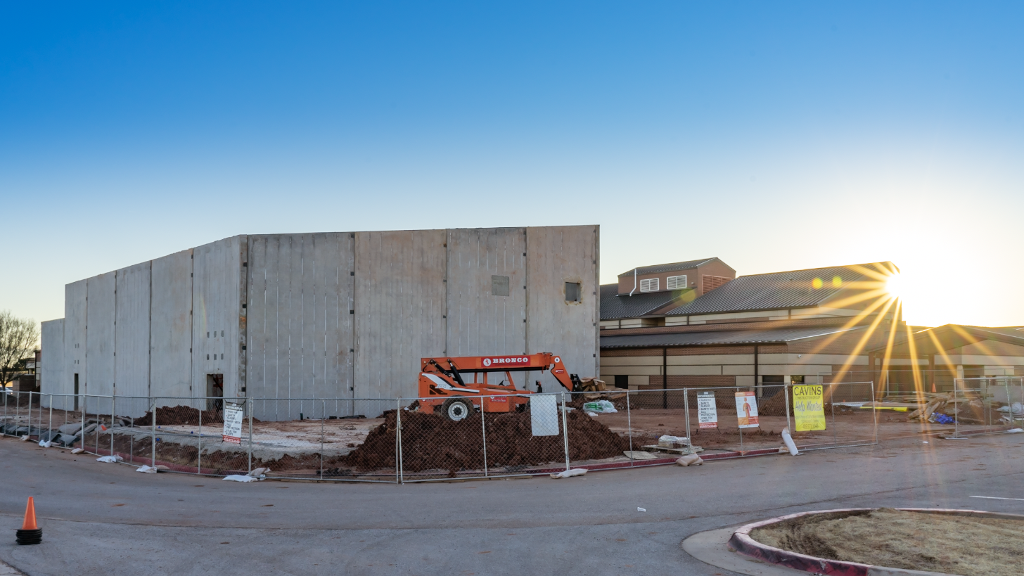
Construction Progression Imagery
Whether it’s before, after, or during your big project, Raven Visual can provide videos and photos periodically to help you track progress and document the site. Our experience in doing timelapse sequences, close quarters aerial flight, and working in challenging lighting situations makes us a preferred vendor for many construction companies.
Tip: Our construction progress media is often used by our clients to help resolve disputes that arise during and after projects are completed. The evidence often allows our clients to settle concerns quickly, often avoiding good-faith concessions.
Drone Photography & Videography
You don’t want an inexperienced drone pilot taking your photos and videos, do you? While we specialize in drone services, we know the drone is just a tool and experience in photography and videography must come first. If your current drone provider is producing photos and videos that don’t WOW you with great color and cinematic flight patterns, let us show you what we can do.
We utilize 1″ or larger camera sensors on all of our drone equipment to get the you better dynamic range. We know when and how to use filters on our camera lenses to get the right look and highest quality images. We have the experience to fly in challenging situations and get dynamic camera movements that less experienced drone pilots simply cannot achieve.
Tip: You can learn a lot about your drone pilot within 10 minutes of watching them operate. Are they methodical in flight preparations? Do they use often “auto” modes for flight or camera settings? Do they know how to read airspace charts and request special flight authorizations from the FAA? Do they have drone liability insurance?
Ground-based Photography & Videography
Because we have always focused on high quality photography and videography skills, we can help you get great quality video on the ground, too! Depending on the situation, we employ everything from action cameras to full-frame pro cameras and can record footage in resolutions up to and beyond 4k.
We are ready to capture your construction project, real estate listing, testimonial interviews, workers in action, or other assets and activities. If you’ve checked into having these services before and were scared away by the cost, give us a chance to show you what we can do and how affordable it can be.
Property Orthomosaics / Maps / Hunting Lease Maps
Are you using Google Maps or Google Earth today, but the resolution of the satellite images is disappointing or insufficient for your needs? We can help!!
Whether you need a few high-resolution images, or a HUGE detailed image of a large property, we are ready to tackle it. Our drones utilize 20 megapixel or larger cameras so you can get the finest details. And, because we have the tools and experience to stitch multiple images together, we can build MUCH larger images. These images can be suitable for creating hunting maps, trail maps, or to provide as a gift to a proud land owner.
How big and how detailed can a map be? We can put together hundreds or thousands of images and cover acres and acres of land. Final images can be 100 megabyte JPGs or larger, depending on your needs. And, the resolution can be 10-100x better than what you see on Google Maps.
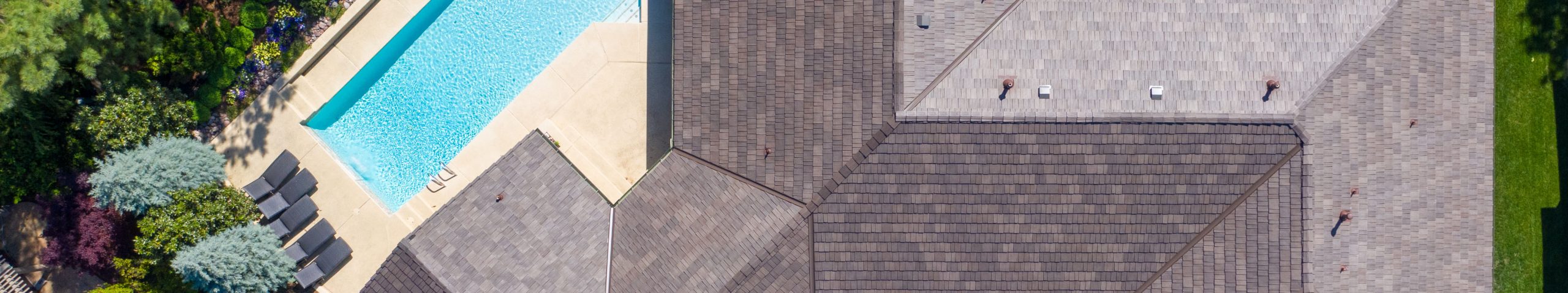
Aerial Inspections & Condition Documentation
NOTHING gives you a new perspective on inspection like getting an aerial view from a drone. Whether you’re checking the condition of a roof or wanting to look closely at a cell phone tower or utility pole, drones can give you VERY clear photos and videos that are often impossible to get without the time and risk of climbing.
Tip: Artificial Intelligence (A.I.) is developing rapidly for inspections and drone imagery is a key part of this trend. A.I. can classify the content of drone images into nuts, bolts, cross arms, braces, antennas, conductors, insulators, and other components automatically. After classification, A.I. can then be trained to look for common defects automatically. This can eliminate the need to have humans looking through all of the inspection photos and videos — they can just focus on the ones where A.I. has detected an anomaly.
Special Event Aerial Live Feeds
From single TVs to large video distribution systems, we can put our drones in the air and provide a live video signal via HDMI to your video equipment. We have utilized this method for search and rescue missions as well as concerts, parades, and race events. The possibilities are endless!
Tip: We can go live by streaming via cellular to a social media network, but we highly recommend using a WiFi broadband connection or a multi-SIM “run gun” bonded cellular connection to keep up with the upload speeds needed to maintain a quality video feed.
Media Assistance with Aerial Video Support
During news-worthy events or disasters, drones can play an integral part of gathering intelligence or providing an additional visual perspective. With our HDMI-out drone feeds, we can provide video signals to news crews or command centers.